
 |
Graves
Locator
|
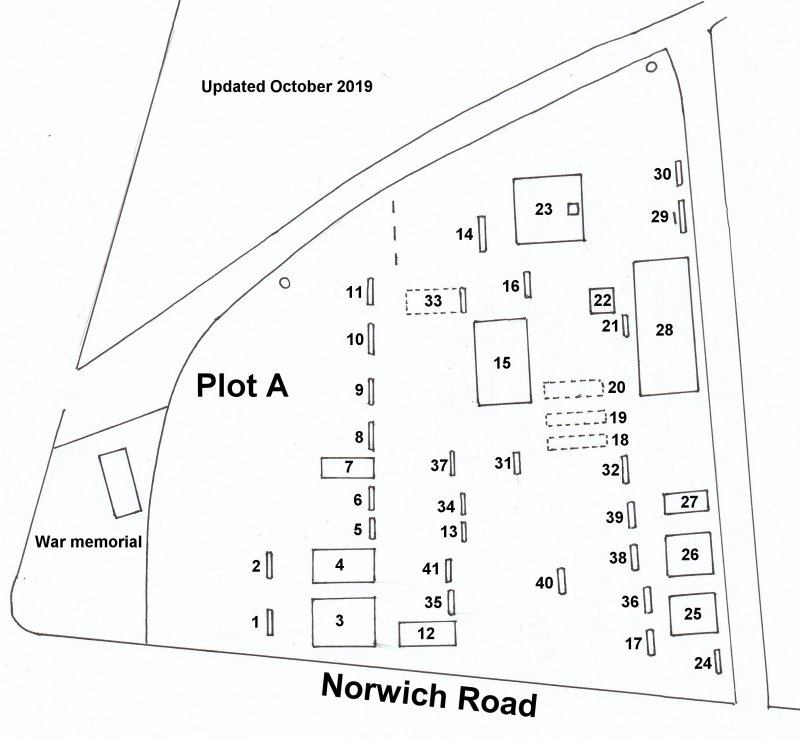
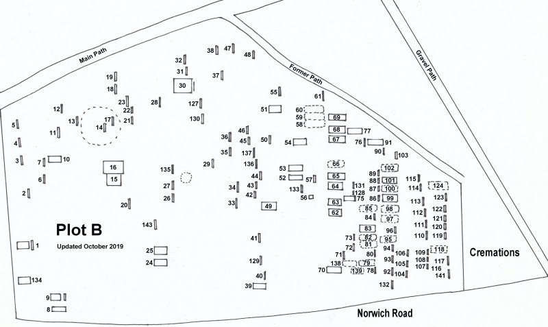
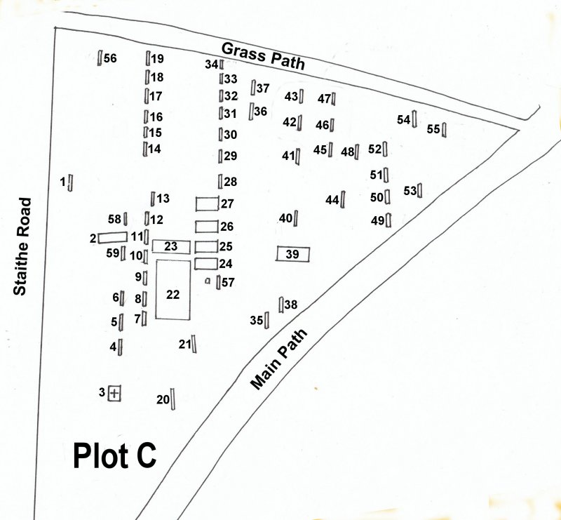
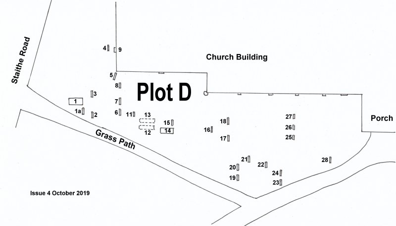
Here you can find maps of all the graves in St Catherine's Churchyard, Ludham which have visible markers.
The churchyard is divided up into Sections A to G (see map below) and in each section, the graves are numbered A1, A2 etc
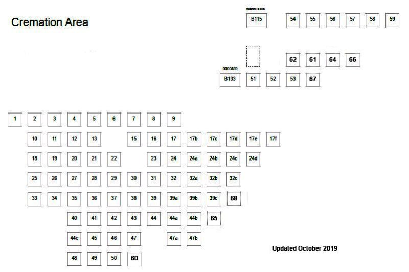
Cremations now have their own section due to the large increase in these types of burials since the 1980s.
The numbers and sections used in the 1980 survey have been retained so you can cross reference.
Please note that all maps are drawn as you would see the Church looking from Norwich Road, so South is at the top.
Click the button below to return to the Graves Survey Main Page
PLOT LOCATOR MAP

MAP OF PLOT A
MAP
OF PLOT B
MAP OF PLOT C
MAP OF PLOT D
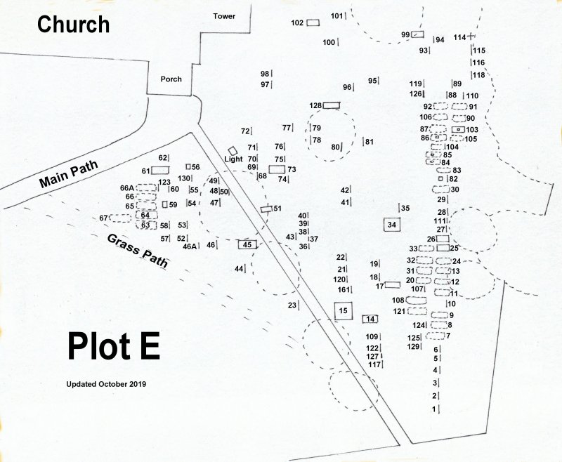
MAP OF PLOT E
MAP OF
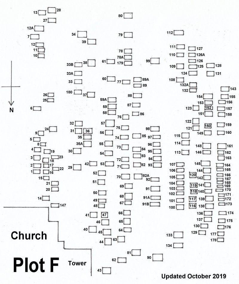
PLOT F
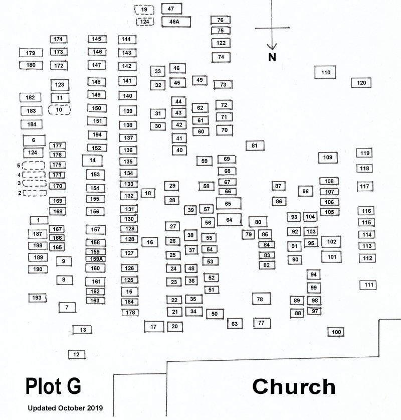
MAP OF PLOT G
MAP OF CREMATIONS
Click this button to go back to the Graves Survey Main Page
